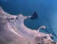
The water level in lakes fluctuates with changes in moisture balance (precipitation minus evaporation) within the lake basin. In closed basin lakes, particularly in arid regions, lake level fluctuations can be dramatic, resulting in fossil shoreline deposits and other features indicative of past lake levels. These data can be used to reconstruct the basin’s moisture balance and climate history.

Accessing Data at the World Data Service for Paleoclimatology
Search Lake Level Reconstruction Data
Search through lake level reconstruction studies using Investigator, Title, Location Name, Parameters, and Latitude/Longitude Bounds.
Search All Paleoclimatology Data
Access a free text search of our entire study archive.
Interactive Map
Select study locations by region, proximity to a point, or text-based attributes.
Google Earth Map
Locate and download lake level studies using a Google Earth map interface. Google Earth must be installed to use this search tool.
NCEI Paleo Web Service
Use the NCEI Paleo Web Service to access lake level reconstruction study metadata records
Browse Lake Level Datasets
Contributing Data
To contribute to the Lake Level archive, review our instructions for contributing data. Prospective data providers can email paleo@noaa.gov to submit data and study description information.
Other Resources
Additional sources of NCEI data and information on lake level histories.


